Categories
Terraced / Pyramidal Structures

Our Terraced Past (Part 3B) – Namibia

Figure 1: Namibia - Fish River Canyon - Like many canyons across the world, this is remains of artificial structures rather than 'geological formations'
Figure 1: Namibia – Fish River Canyon – Like many canyons across the world, this is remains of artificial structures rather than ‘geological formations’

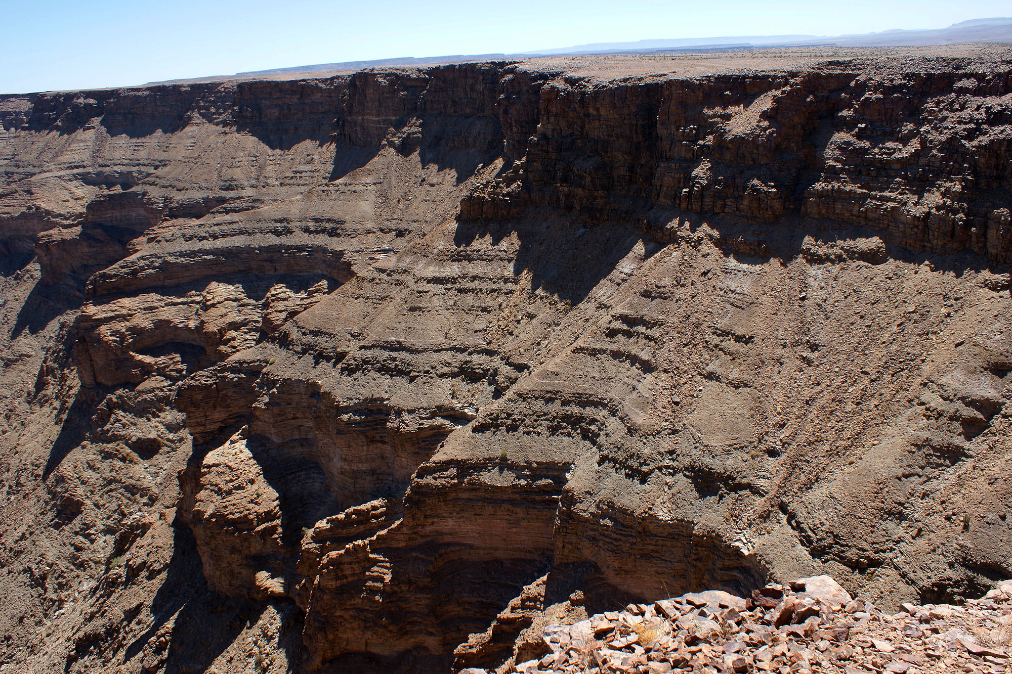
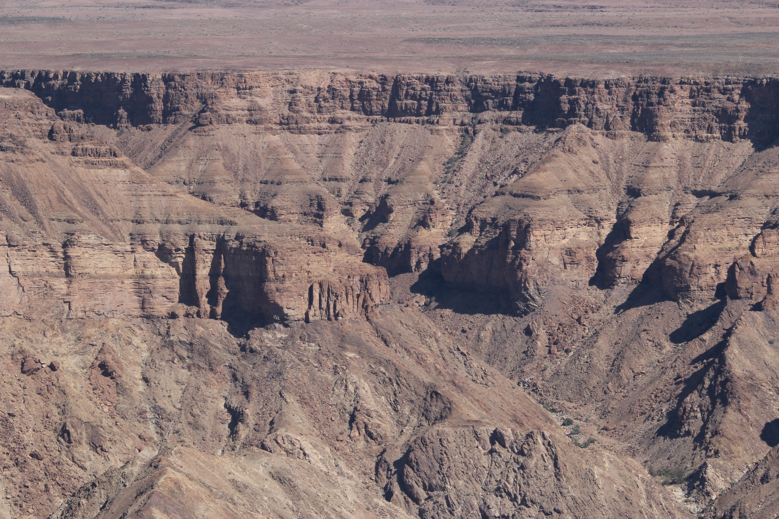
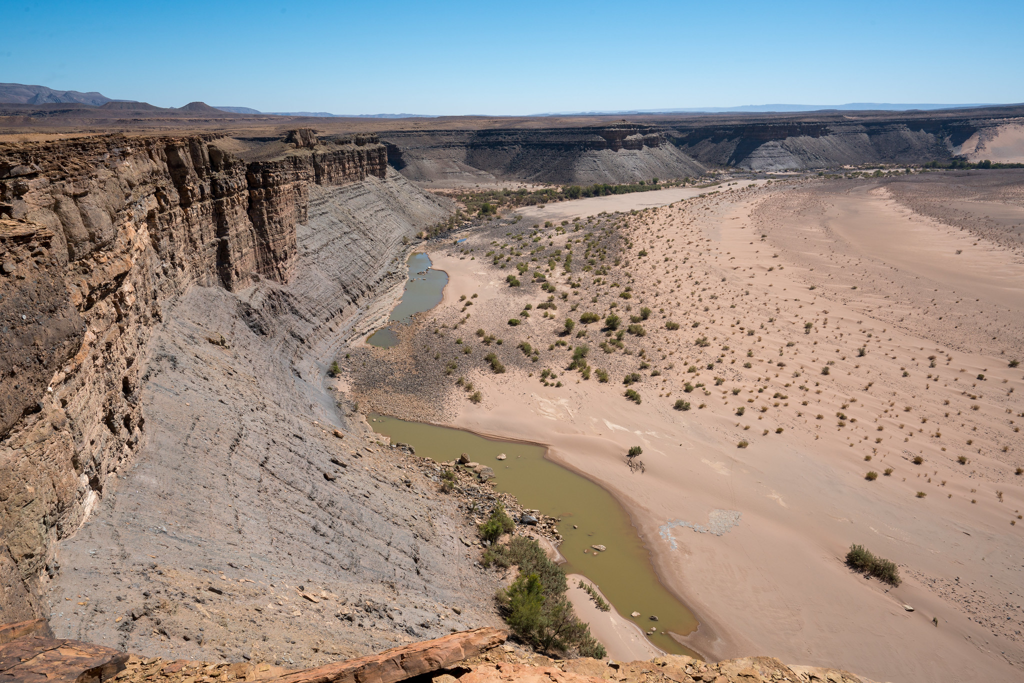
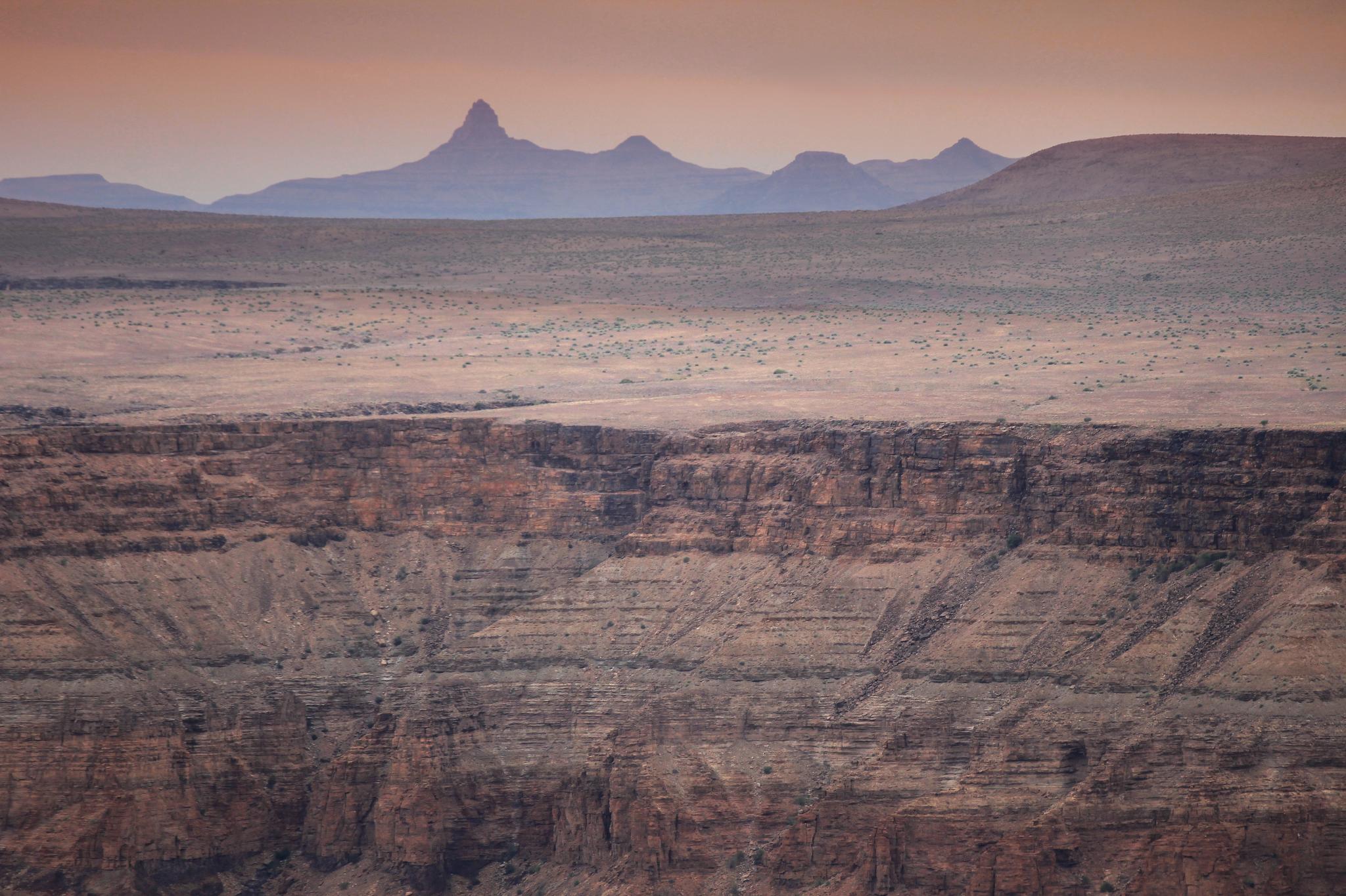
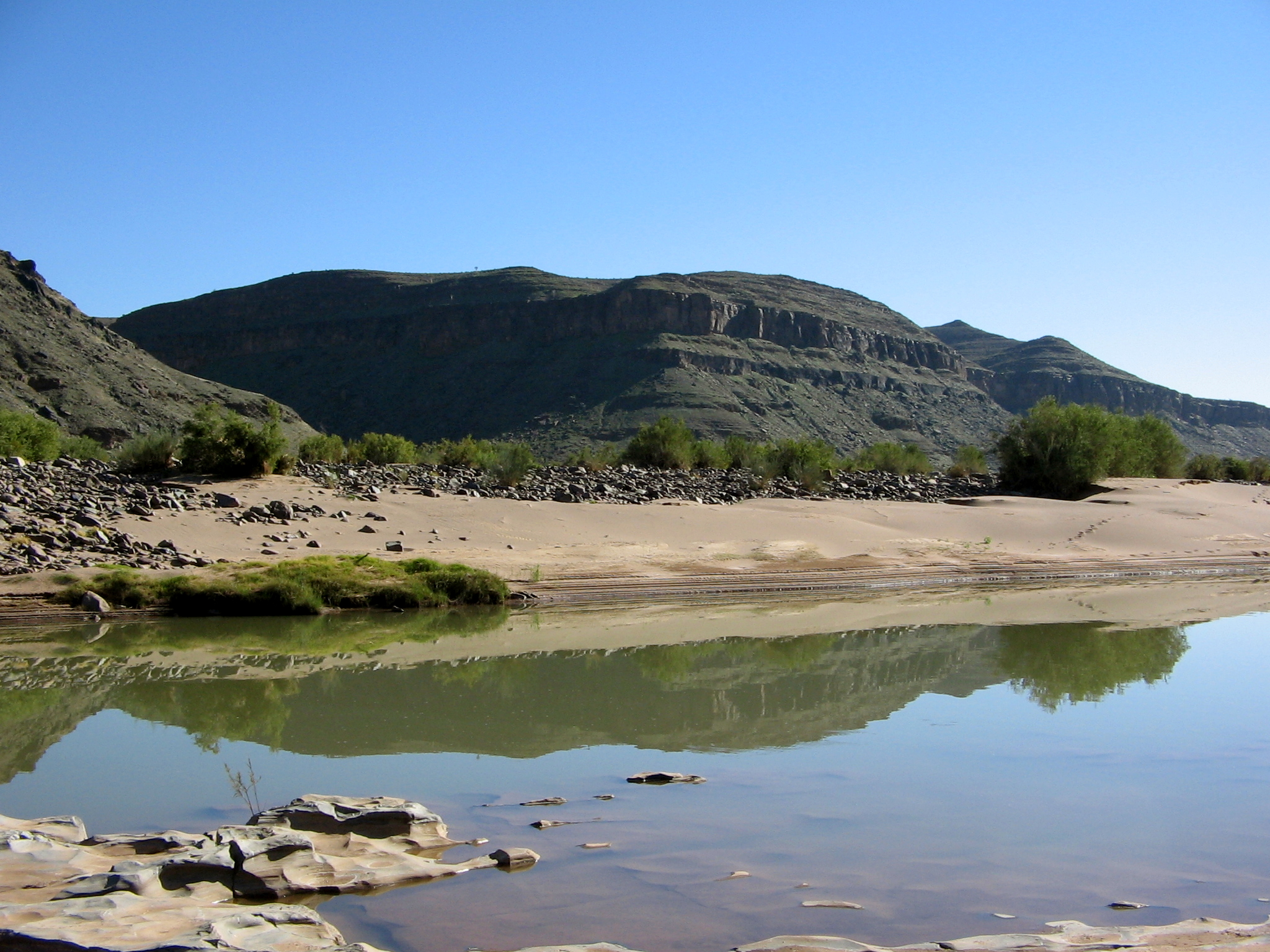
Fish River Canyon, Namibia

Please see Part A for the initial introduction.

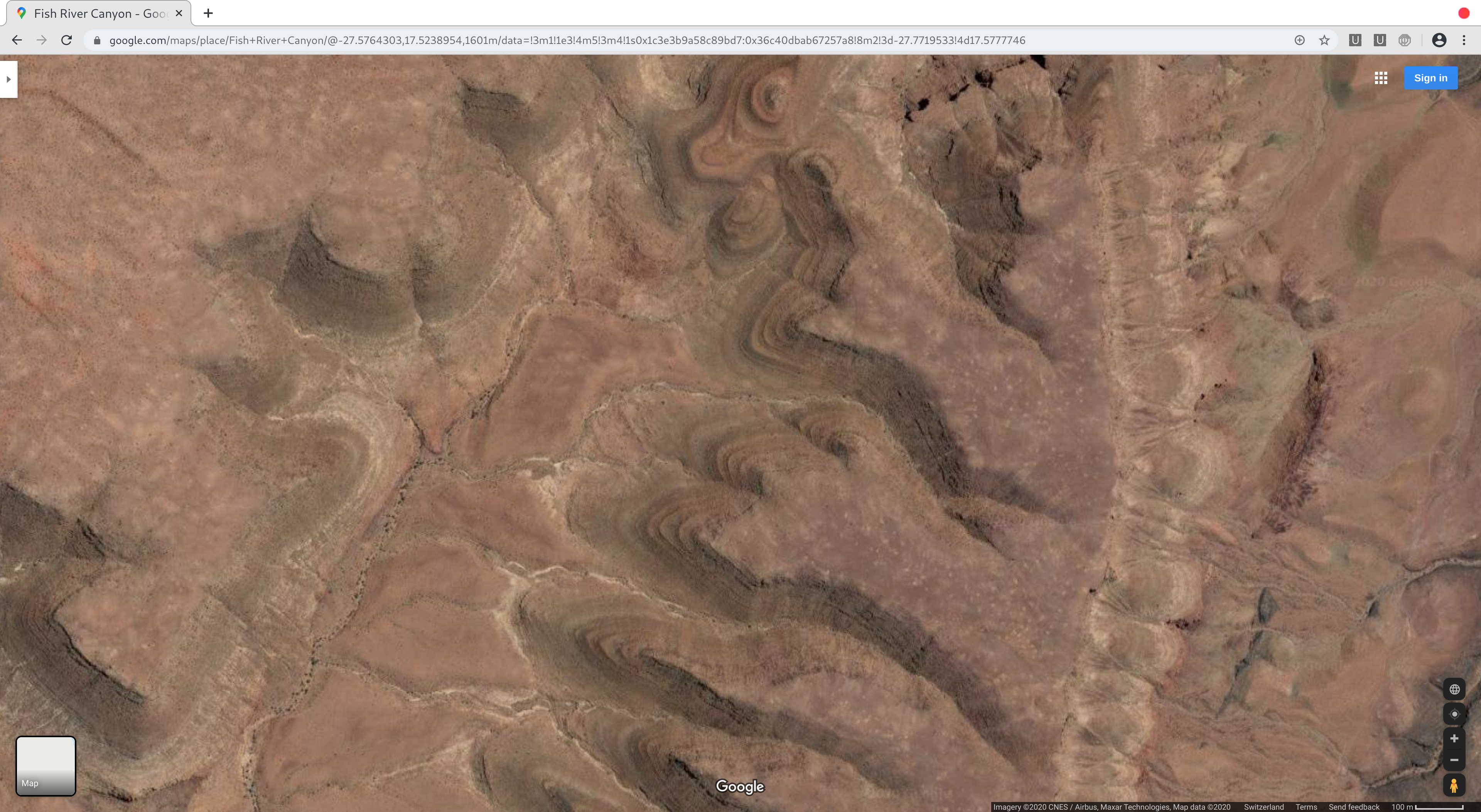
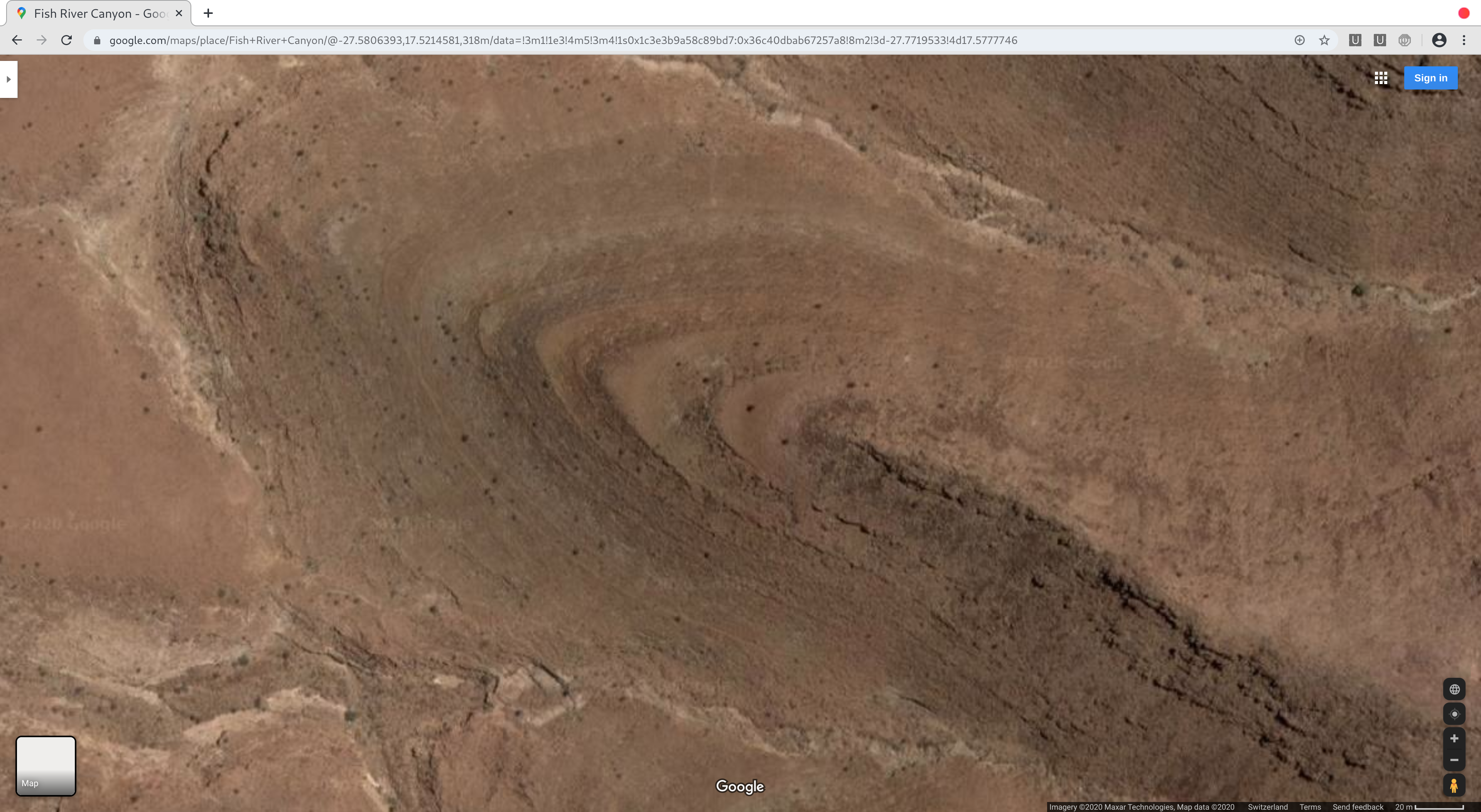
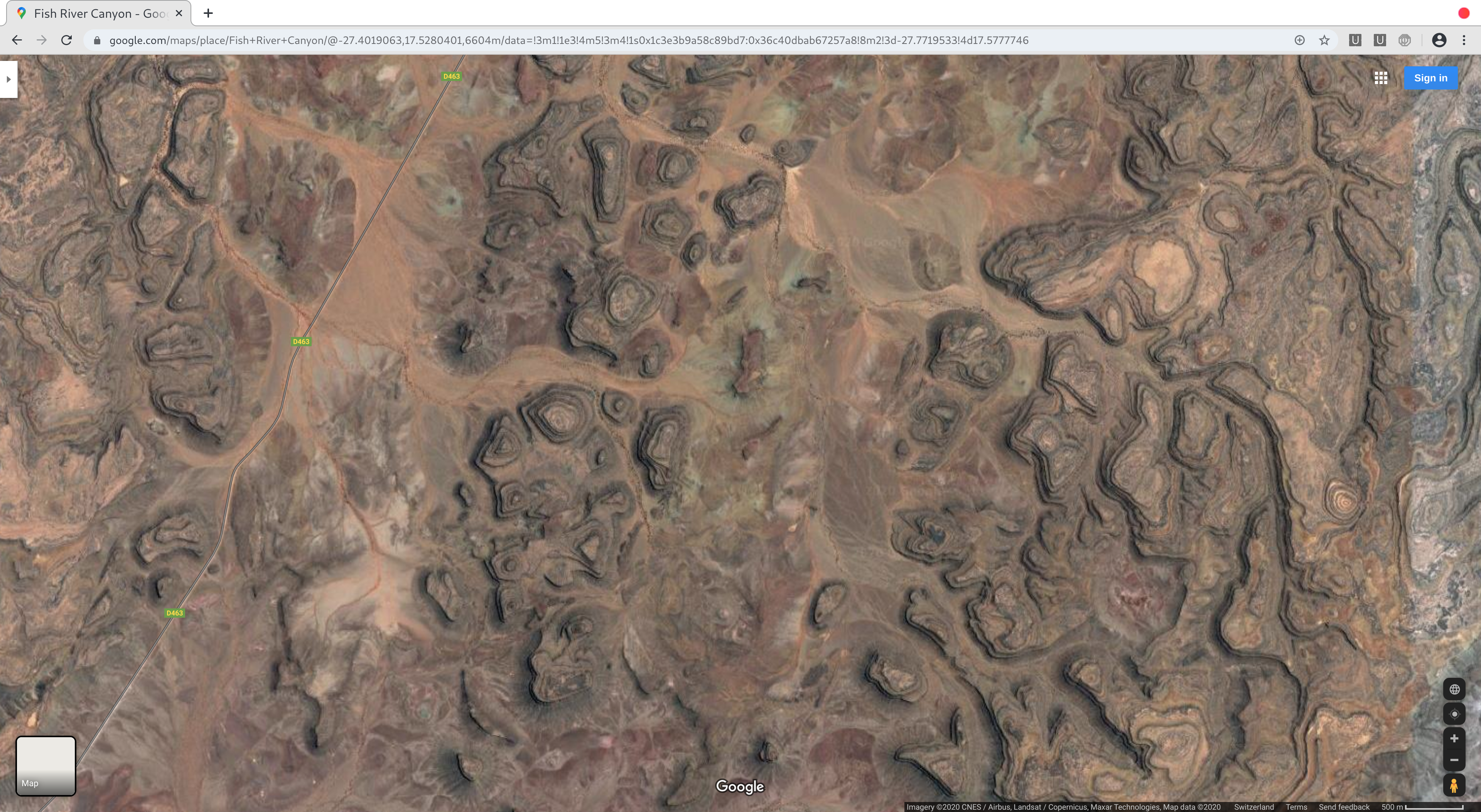
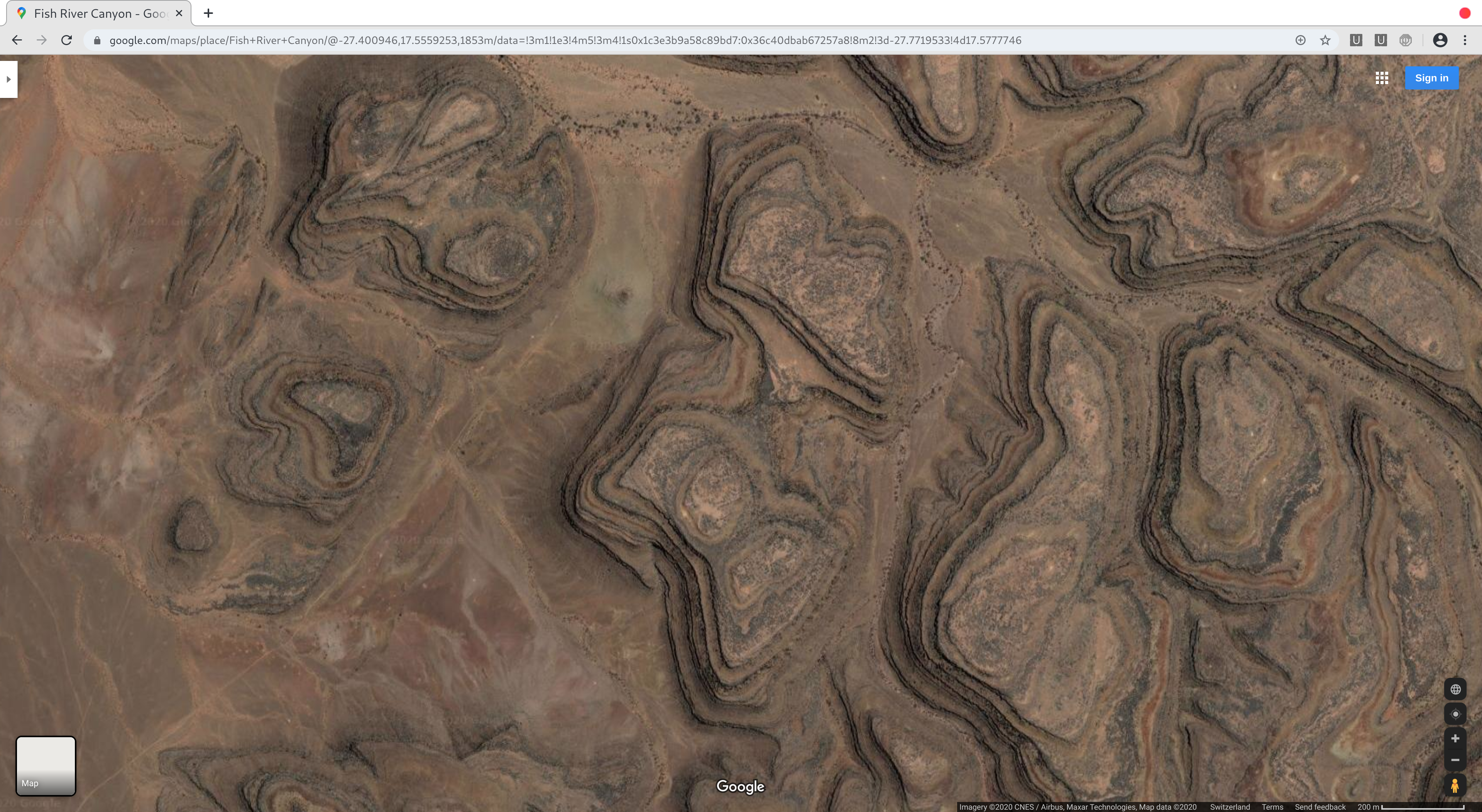
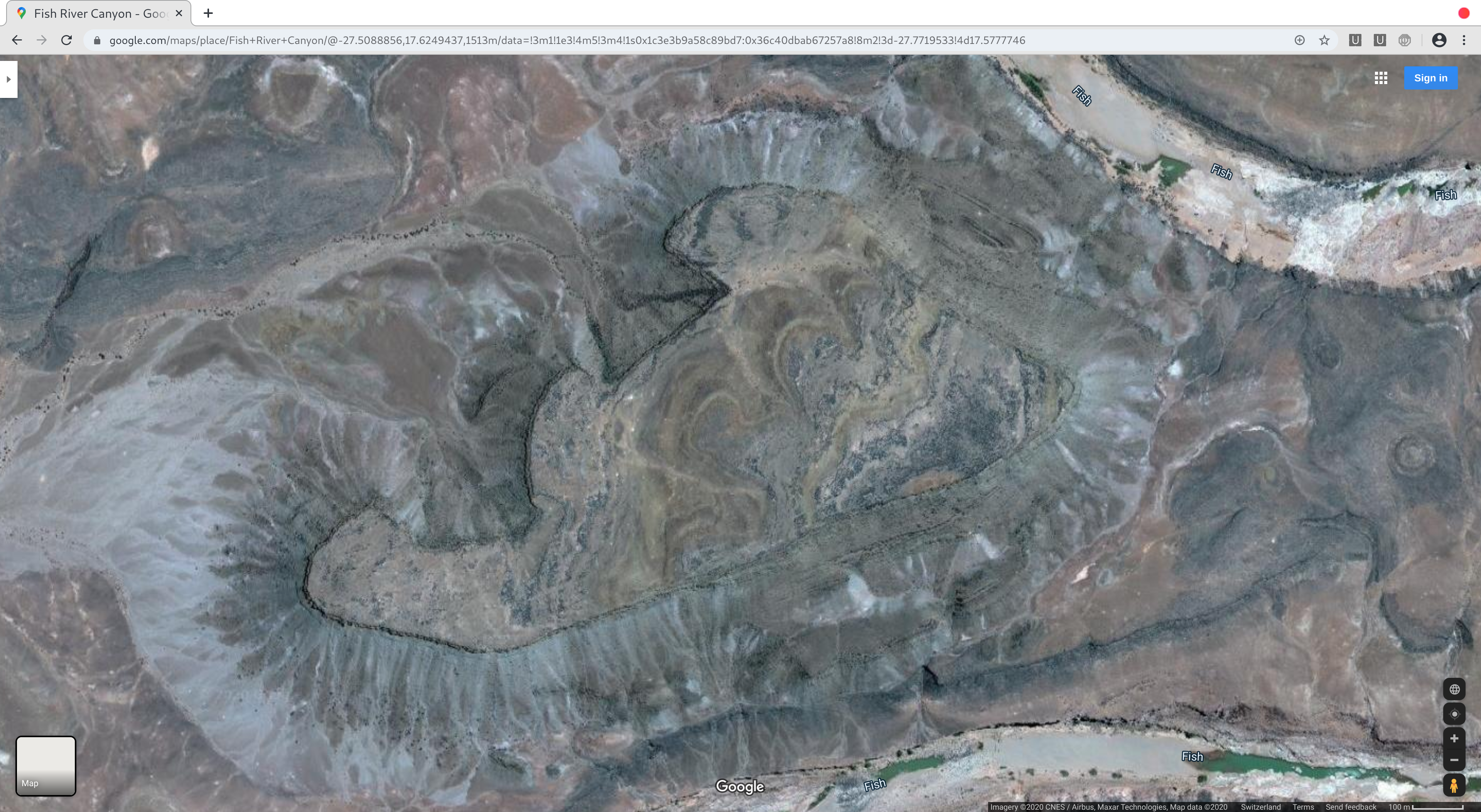
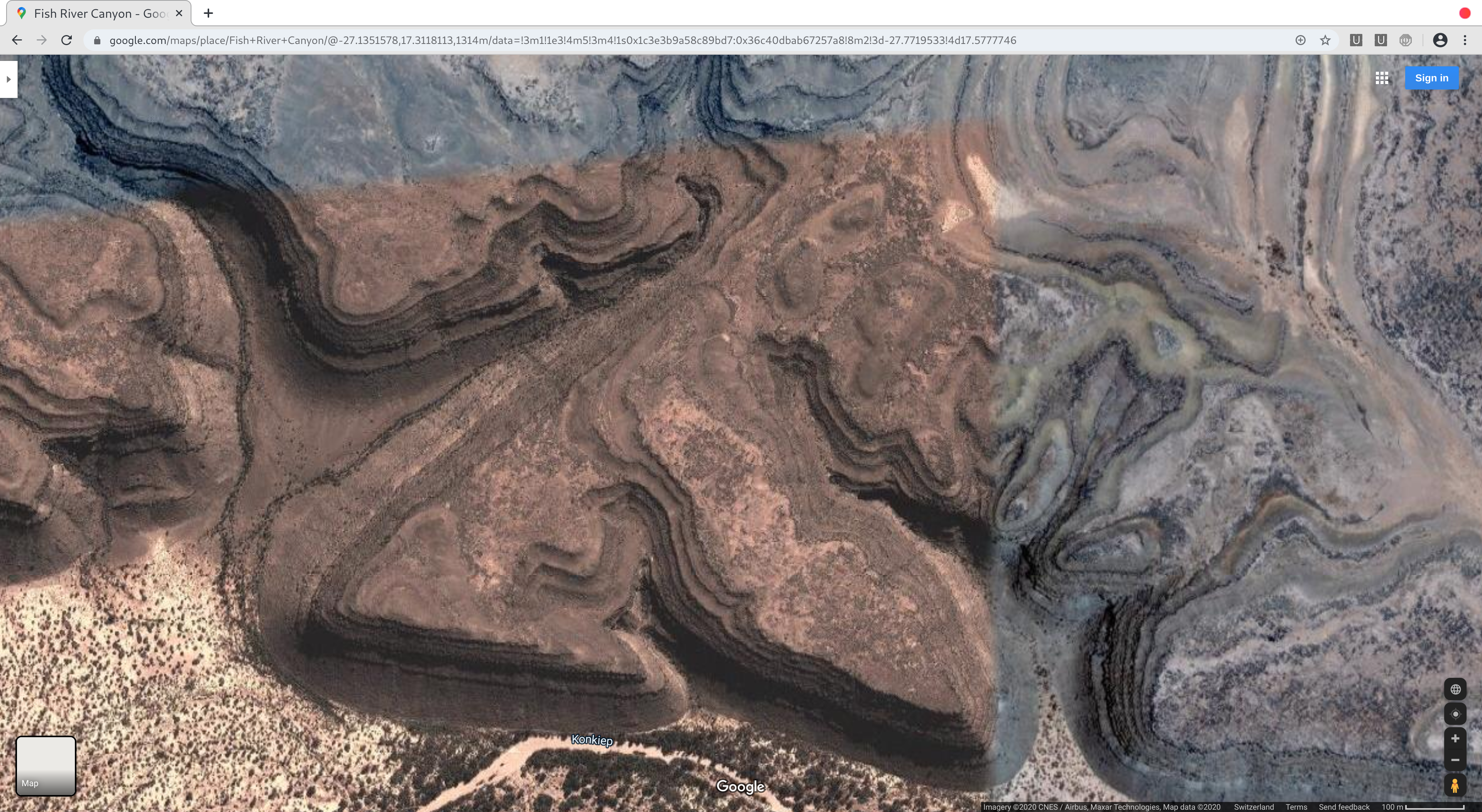
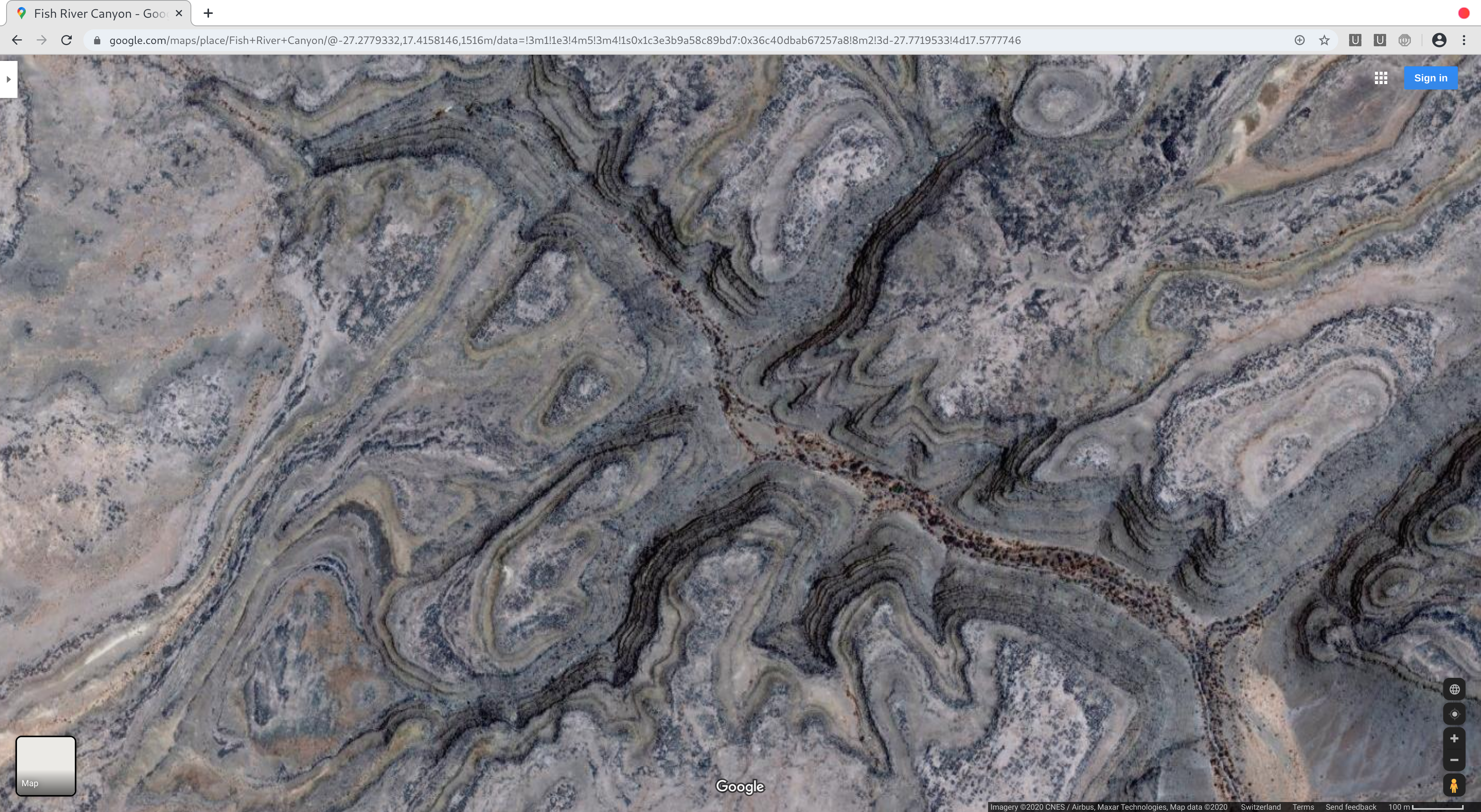
Geologists tell us that canyons are formed by the action of water flowing over and through the landscape. It is also possible that at least some are the remains of civilisations that built up around rivers, like many cities we see today. Of course, we do not dispute that water and other environmental factors have helped shaped the current landscape. However, erosion/weathering do not account for the terracing style seen at many of these sites ie they were built that way.

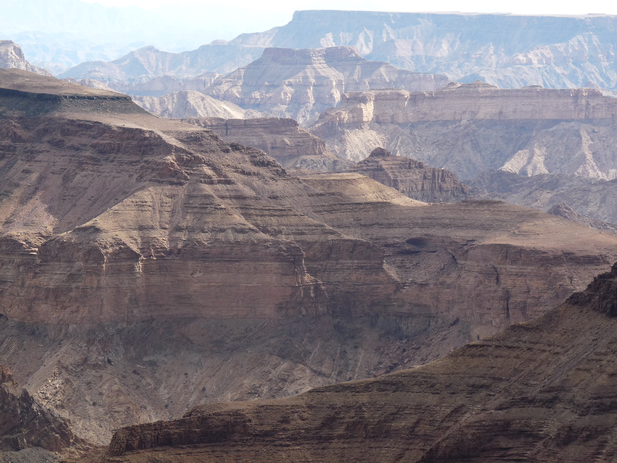
We will begin looking at overhead shots of the region in Google Maps / Bing Maps before taking a look at photos taken on the ground. The overhead shots alone show the artificial terraced nature of these structural remains.

Figure 2: Namibia - Google Maps - Fish River Canyon - Overhead shot demonstrates the terraced artificial nature of these structural remains
Figure 2: Namibia – Google Maps – Fish River Canyon – Overhead shot demonstrates the terraced artificial nature of these structural remains
Figure 3: Namibia - Google Maps - Fish River Canyon - Close-up of part of Figure 2, definition is still evident on the terraced layers of this structural remain
Figure 3: Namibia – Google Maps – Fish River Canyon – Figure 2 close-up – The pointed shape of these artificial terraced levels still remains
Figure 4: Namibia - Google Maps - Fish River Canyon - Overhead view of large area of terraced structure remains
Figure 4: Namibia – Google Maps – Fish River Canyon – Overhead view of large area of terraced structure remains
Figure 5: Namibia - Google Maps - Fish River Canyon - Terraced levels clearly visible
Figure 5: Namibia – Google Maps – Fish River Canyon – Terraced levels clearly visible
Figure 6: Namibia - Google Maps - Fish River Canyon - Shape arguably not of natural original (note the angles)
Figure 6: Namibia – Google Maps – Fish River Canyon – Shape arguably not of natural original (note the angles)
Figure 7: Namibia - Google Maps - Fish River Canyon - Terraced levels of structural remains still visible
Figure 7: Namibia – Google Maps – Fish River Canyon – Terraced levels of structural remains still visible
Figure 8: Namibia - Google Maps - Fish River Canyon - More terraced remains
Figure 8: Namibia – Google Maps – Fish River Canyon – More terraced remains
Figure 9: Namibia - Fish River Canyon - Structural remains (everything in the photo)
Figure 9: Namibia – Fish River Canyon – Structural remains (everything in the photo)
Figure 10: Namibia - Fish River Canyon - Terracing defines the landscape today
Figure 10: Namibia – Fish River Canyon – Terracing defines the landscape today
Figure 11: Namibia - Fish River Canyon - More terraced landscape
Figure 11: Namibia – Fish River Canyon – More terraced landscape
Figure 12: Namibia - Fish River Canyon - Note the shape of the landscape towards the back of the image - This may have been a reservoir in prior times
Figure 12: Namibia – Fish River Canyon – Note the shape of the landscape towards the back of the image – This may have been a reservoir in prior times
Figure 13: Namibia - Fish River Canyon - More terracing (made of brick)
Figure 13: Namibia – Fish River Canyon – More terracing (made of brick)
Figure 14: Namibia - Fish River Canyon - Remains of building - Note the circular terraced feature on the near corner
Figure 14: Namibia – Fish River Canyon – Remains of building – Note the circular terraced feature on the near corner