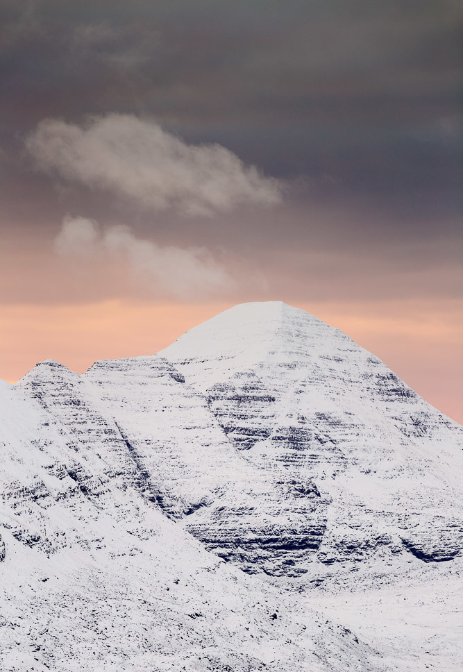
Figure 1: Sgurr Mor – Torridon Hills – Scotland – Remains of pyramidal structure
Most mountains are the remains of buildings.
It is surmised that the mountainous areas of today are the built-up areas of the ancient past that perhaps went through (at least) a cataclysm event such as the great flood event spoken of in many ancient texts and were broken up, subsided, and covered in mud which dried and eventually turned to ‘rock’. They have since had further build-up of mud and sediment and weathering action/erosion and further subsidence/buckling to leave what we see today.
In this post we will look at pictures of the Torridon Hills in the Highlands of Scotland and the Three Zinnen in the Dolomites of Italy, which are the remains of structures rather than simply just random ‘geological formations’. This post will be the first of many in this series.
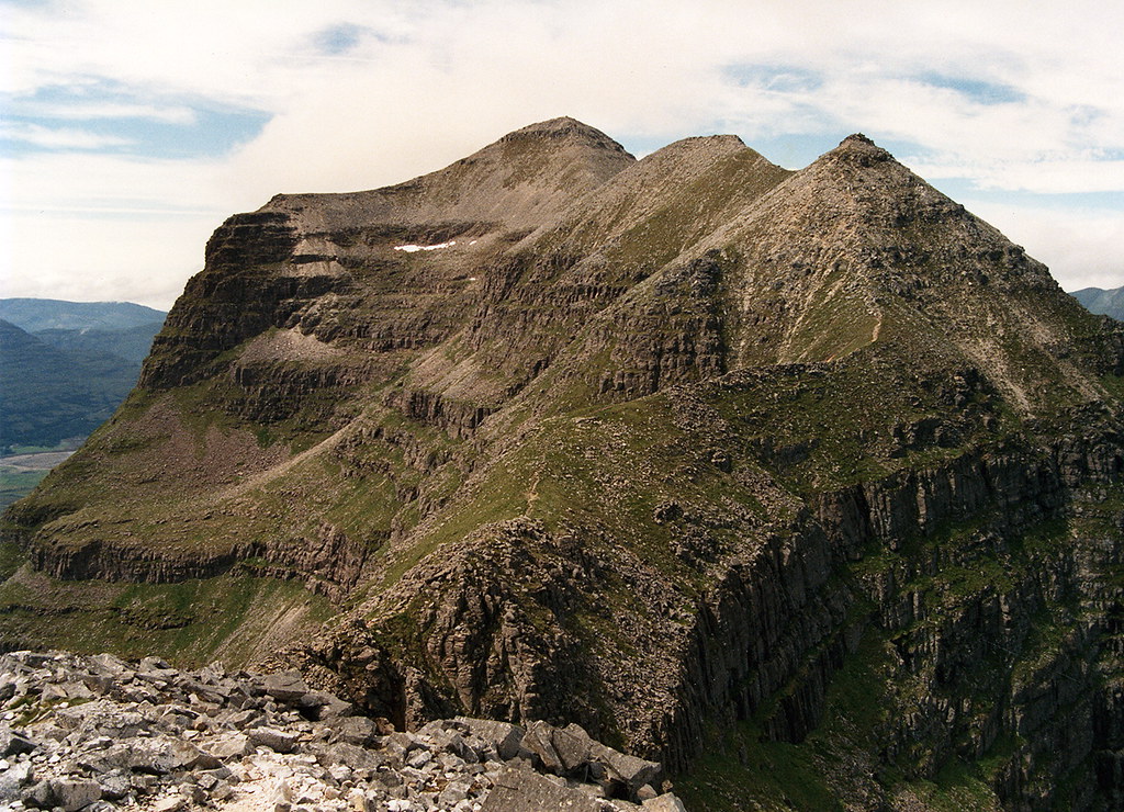
Figure 4: Liathach – Torridon Hills – Scotland – Remains of stepped, pyramidal structures (in the background)Figure 5: Liathach – Torridon Hills – Scotland – Pyramid shape still visible (on left of image)Figure 6: Liathach – Torridon Hills – Scotland – The 3 summits are different shapes, the nearest one is obviously in the shape of a pyramidFigure 7: Torridon Hills – Scotland – The base of this ‘mountain’ can be seen to be the remains of a huge circular terraced formation. Other examples of this architectural style have been shown on this site. Figure 8: Torridon Hills – Scotland – The original brickwork can still be seen in parts on the side of this ‘mountain’ (the remains of a large building)Figure 9: Torridon Hills – Scotland – Remains of terraced levels
Interestingly, when I explored the area further on Google Maps, there was a line of ‘blur’ running through area which obscured the summit which prevented further scrutiny:
Figure 10: Google Maps – Torridon Hills – Scotland – Blurry line is seen to obscure overhead shot of summit / high areas
Similarly, it could not be viewed on Bing Maps either, with a strange colour effect obscuring the view:
Figure 11: Bing Maps – Same location as Figure 10 – Torridon Hills – Scotland – Weird colour effect is seen to obscure overhead shot
It was mentioned in the last post (here) how Google Maps can be seen to obscure features relevant to the topic of this website on its online mapping application. It could be argued that Bing Maps is doing the same in the shot above. Are they trying to hide our real ancient history or are they just more coincidences? I will continue to show examples of this and you can draw your own conclusions.
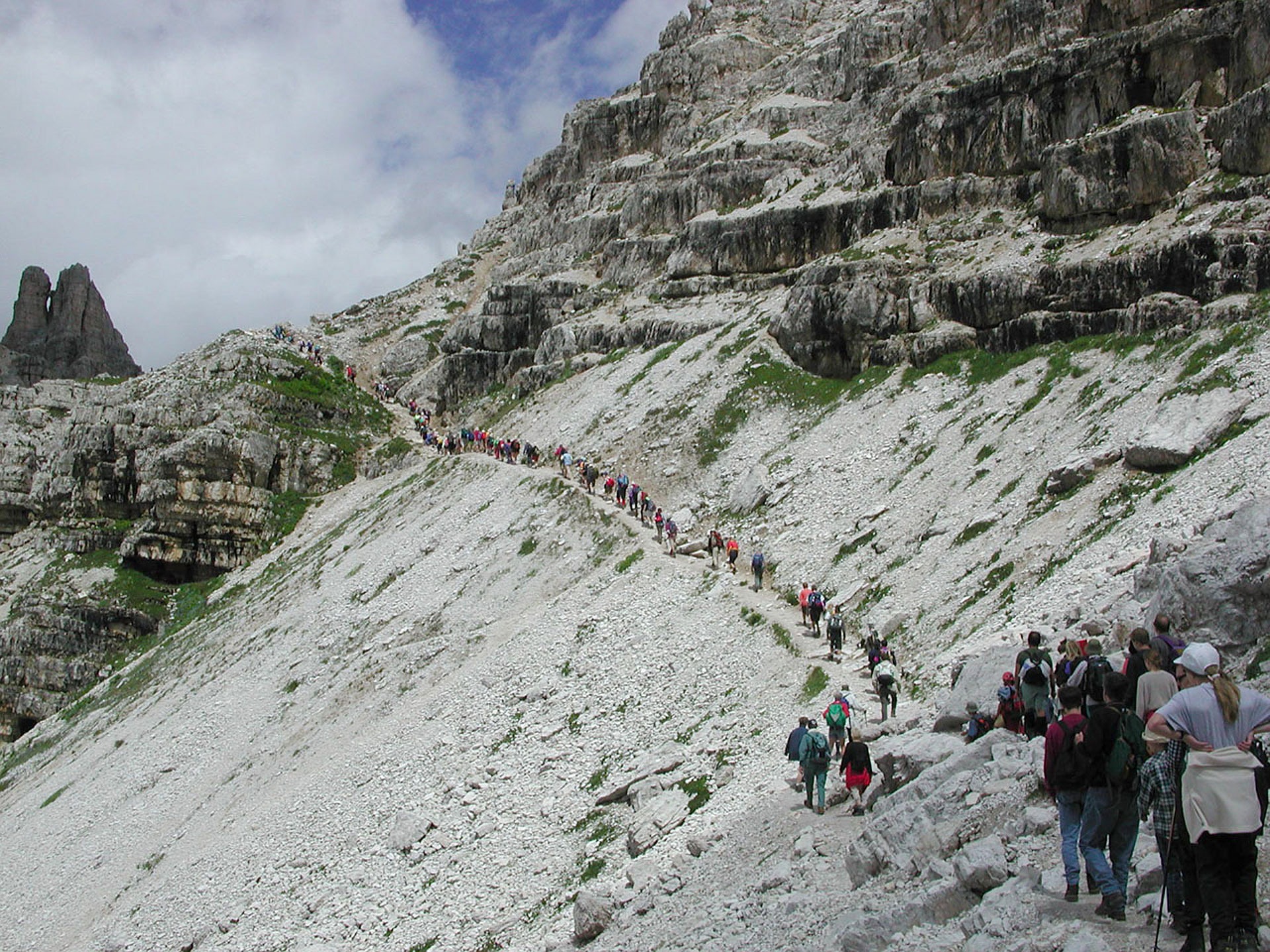
Three Zinnen, Dolomites
Figure 12: Three Zinnen – Dolomites – Remains of artificial structureFigure 13: Three Zinnen – Dolomites – Note the straight, regular levels which shows that this is the remains of an artificial construction Figure 14: Three Zinnen – Dolomites – Regular layers of stonework still visibleFigure 15: Three Zinnen – Dolomites – Walkers on the remains of a giant artificial construction