Categories
Terraced / Pyramidal Structures

Our Terraced / Domed Past (Part 4) – Western Australia

Figure 1: Millstream Chichester National Park - Google Maps image shows artificial origin of 'mountains'
Figure 1: Millstream Chichester National Park – Google Maps – Close-up of bottom part of Figure 3 – Top of hill shows geometry which is arguably not of natural origin (note the perfect curves)

Millstream Chichester National Park, Western Australia

This is part one of a two-part series looking at National Parks in Western Australia, namely Millstream Chichester and Karijini.

We have updated the title of this series to ‘Terraced / Domed’ structures rather than simply ‘Terraced’. The remains of the structures that we see today do indeed often have a stepped appearance. However they could have been originally domed structures as we only have the remains to study. We just can’t be sure.

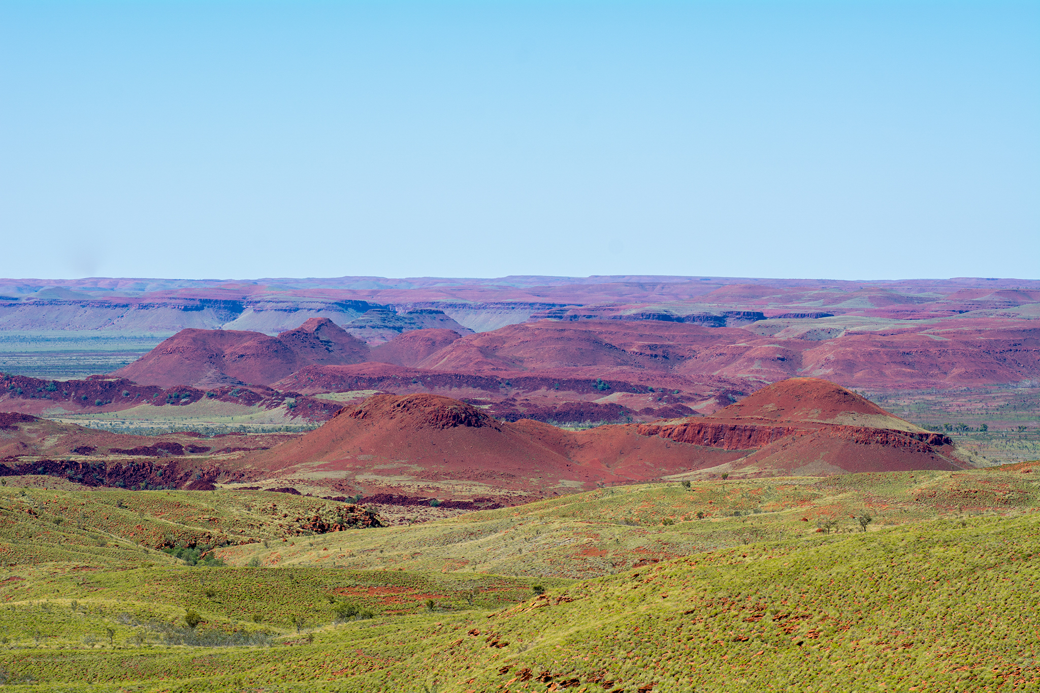
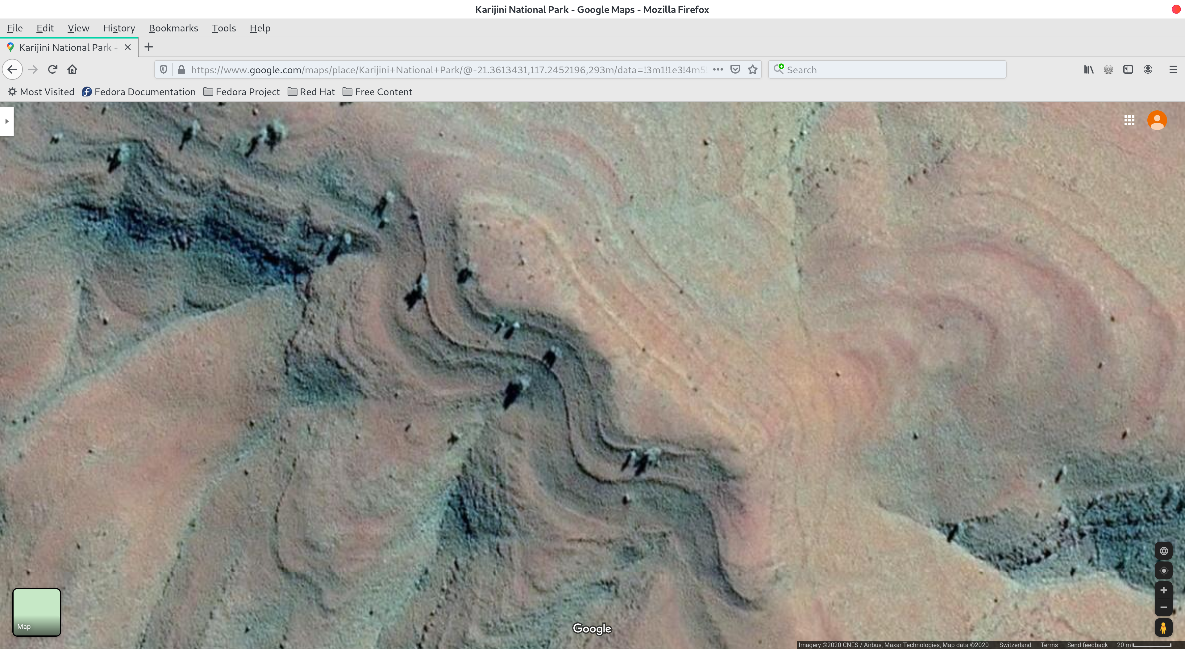
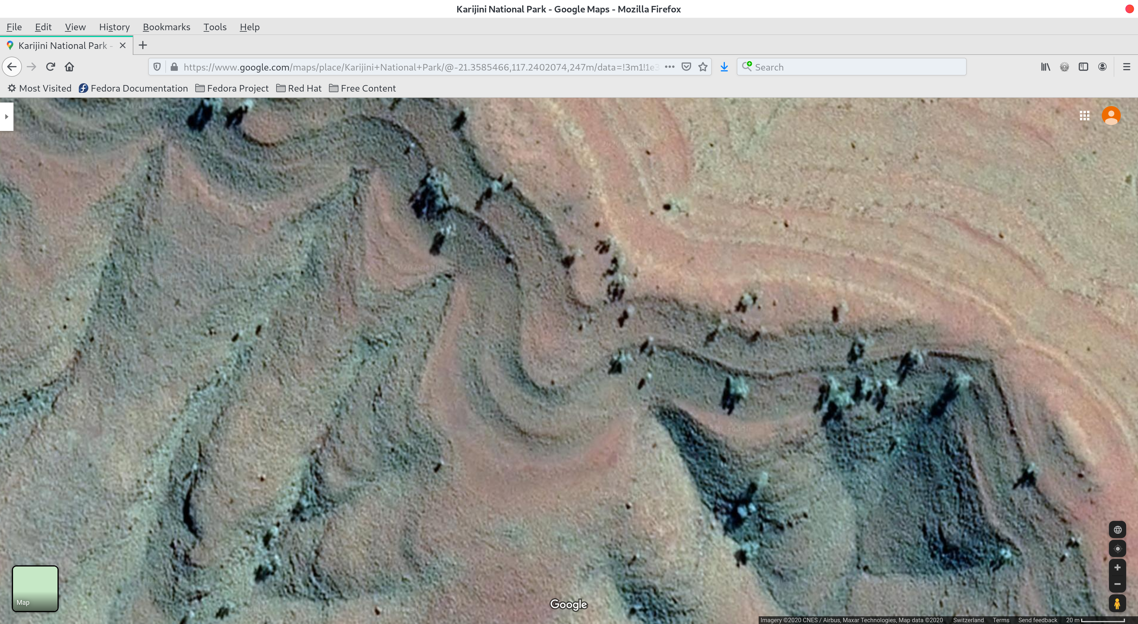
It is useful for us to clarify what ‘terraced / domed structures’ look like on Google Maps and Bing Maps. Despite the apparent age and condition of these remains, one can, in some places, still find clear traces of their artificial origin and advanced engineering, as in Figure 1.

(please ignore all image titles which refer to an earlier search for Karijini with Google Maps, all images are from Millstream Chichester and can be clicked for greater detail):

Figure 2: Millstream Chichester National Park - Google Maps
Figure 2: Millstream Chichester National Park – Google Maps – Remains of ancient buildings

The reason for the ‘terraced’ description is self-evident. Although we have been told these are natural features (ie ‘mountains’), this is simply not possible. Water does not erode in a stepped fashion like we see in the image. Geologists cannot (and do not) account for this according to our research. If any geologists are reading this and wish to let us know otherwise, please get in touch.

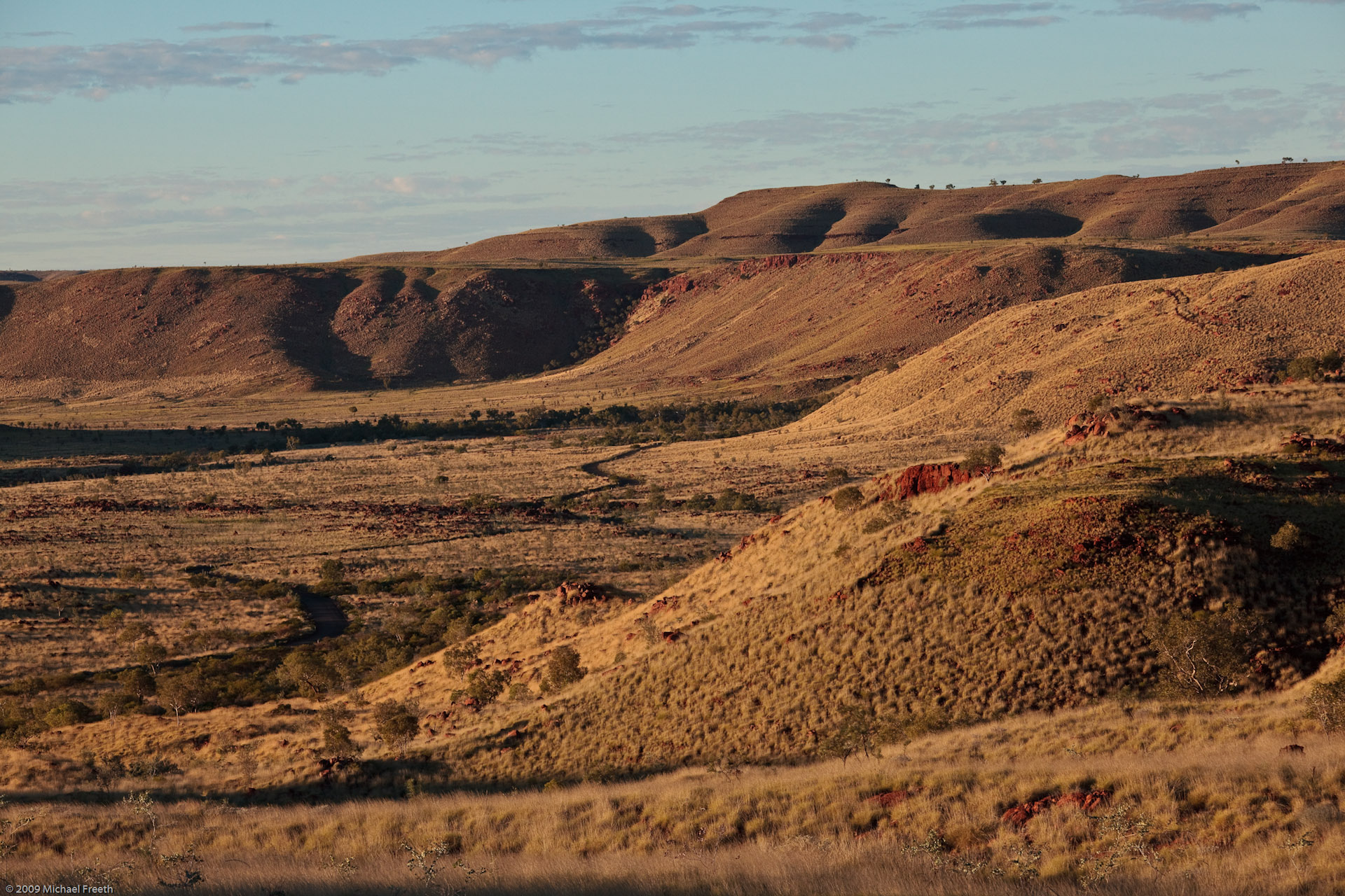
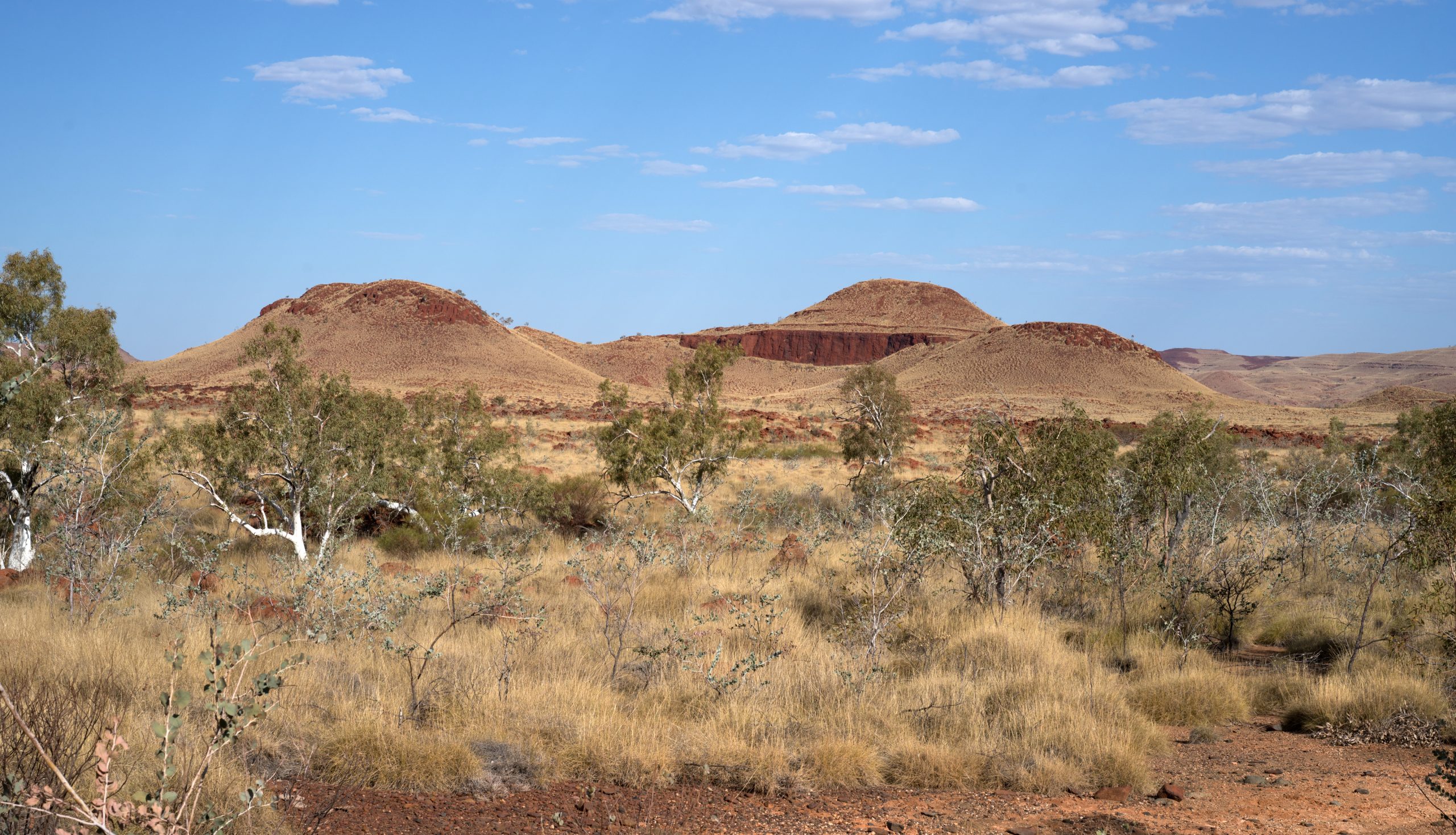
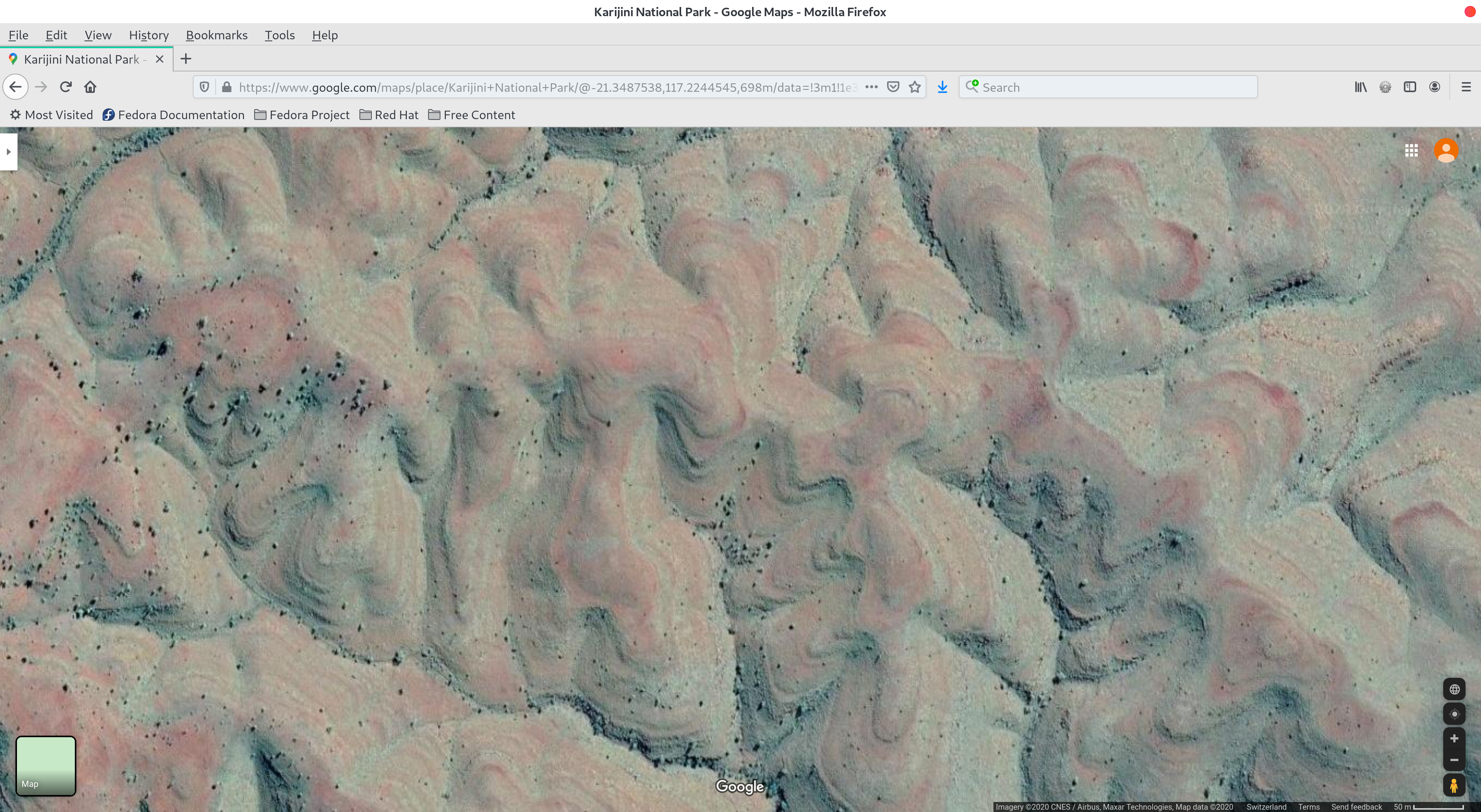
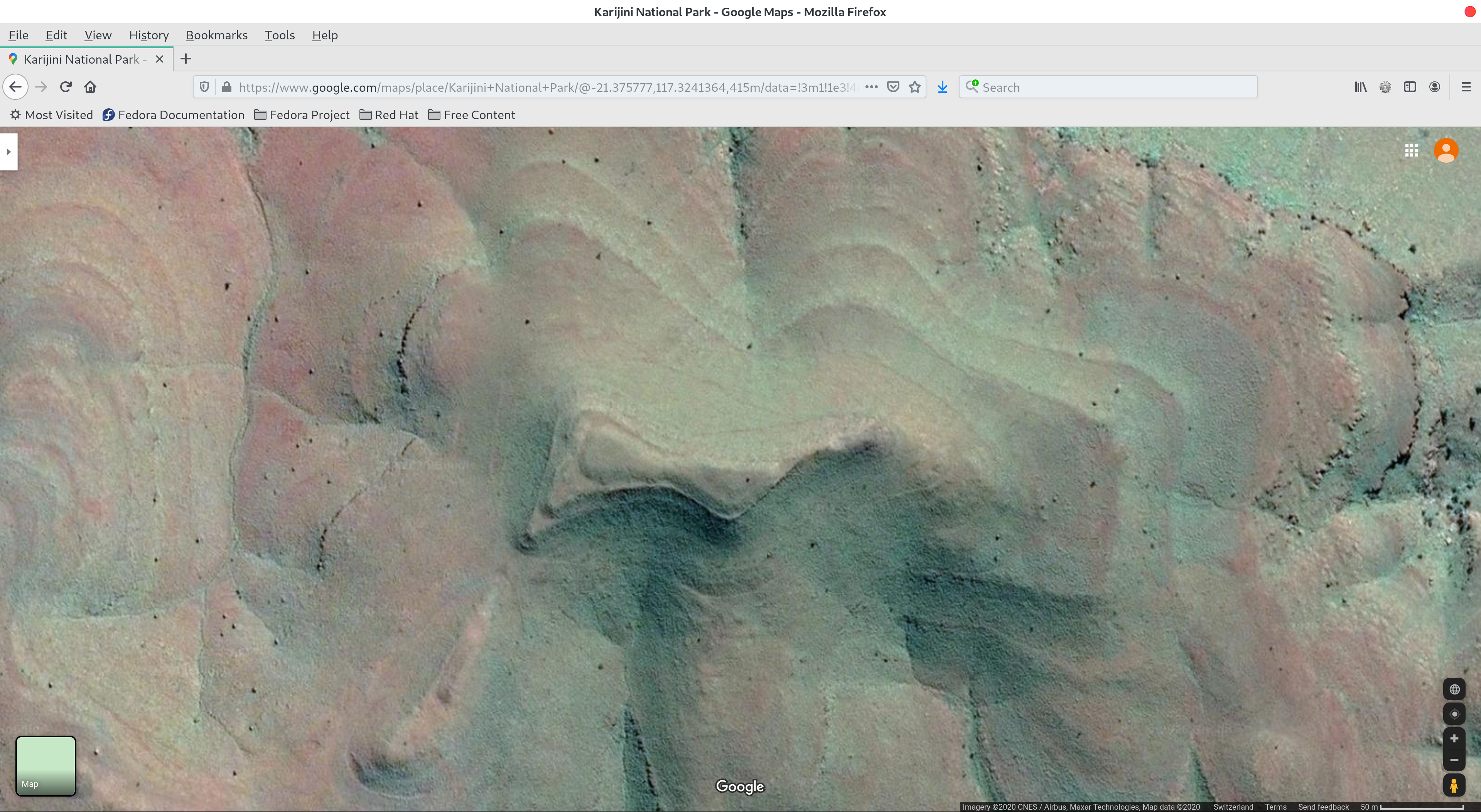
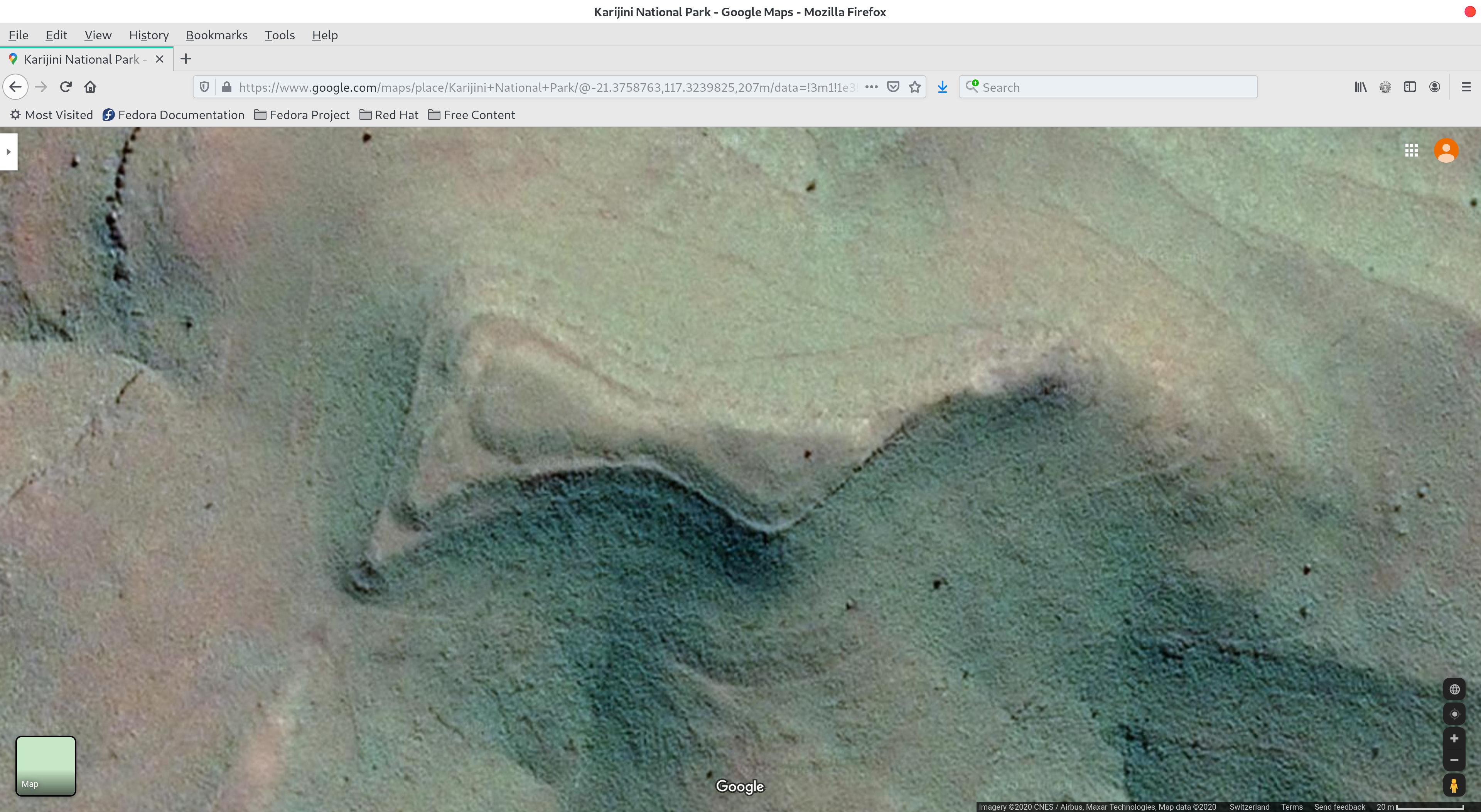
Here are some more notable images from this area:

Figure 3: Millstream Chichester National Park - Google Maps
Figure 3: Millstream Chichester National Park – Google Maps – Mountain ridge shows multiple examples of artificial design
Figure 4: Millstream Chichester National Park - Google Maps
Figure 4: Millstream Chichester National Park – Google Maps – Close-up of top part of Figure 3
Figure 5: Millstream Chichester National Park - Google Maps
Figure 5: Millstream Chichester National Park – Google Maps – Close-up of top part of Figure 3

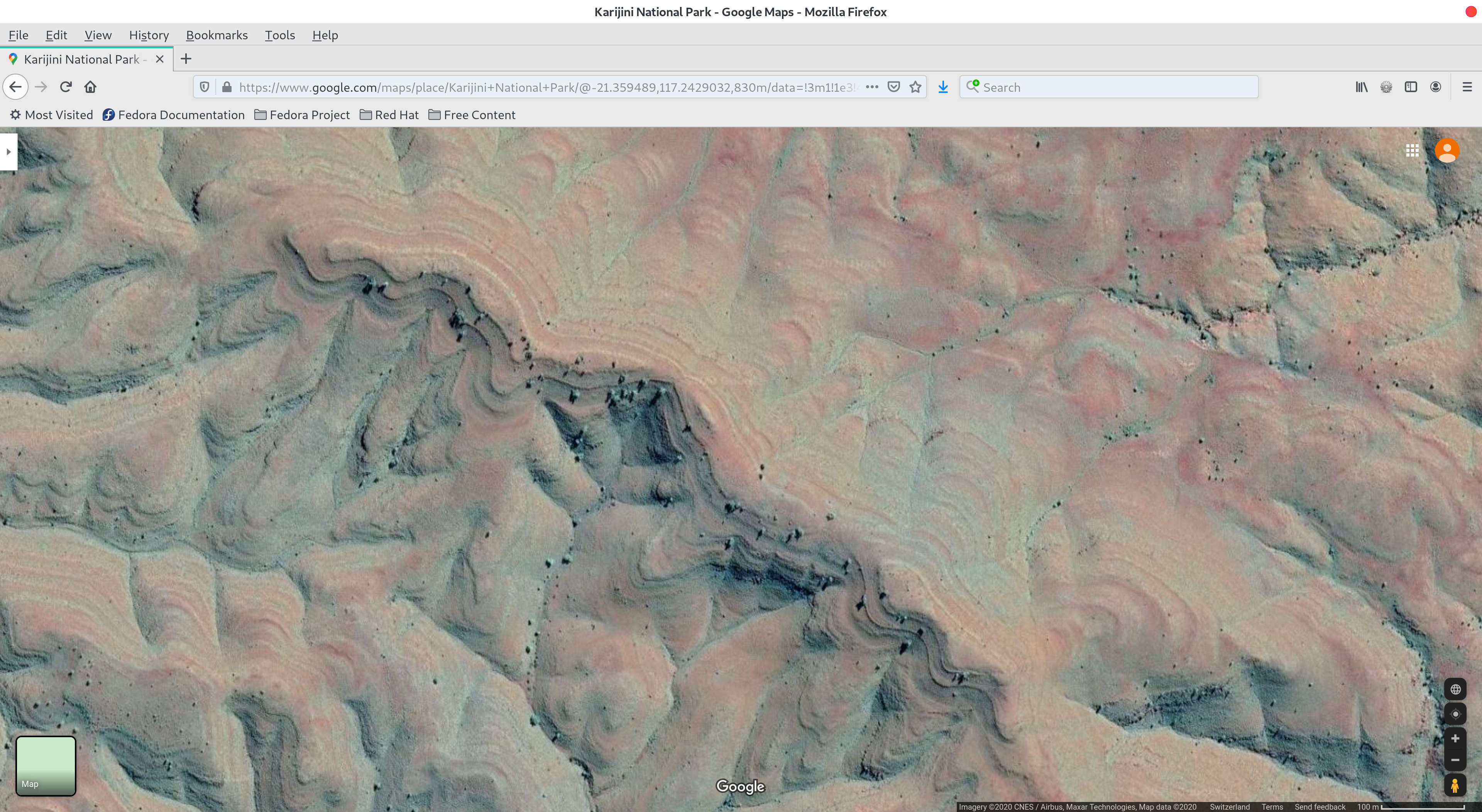
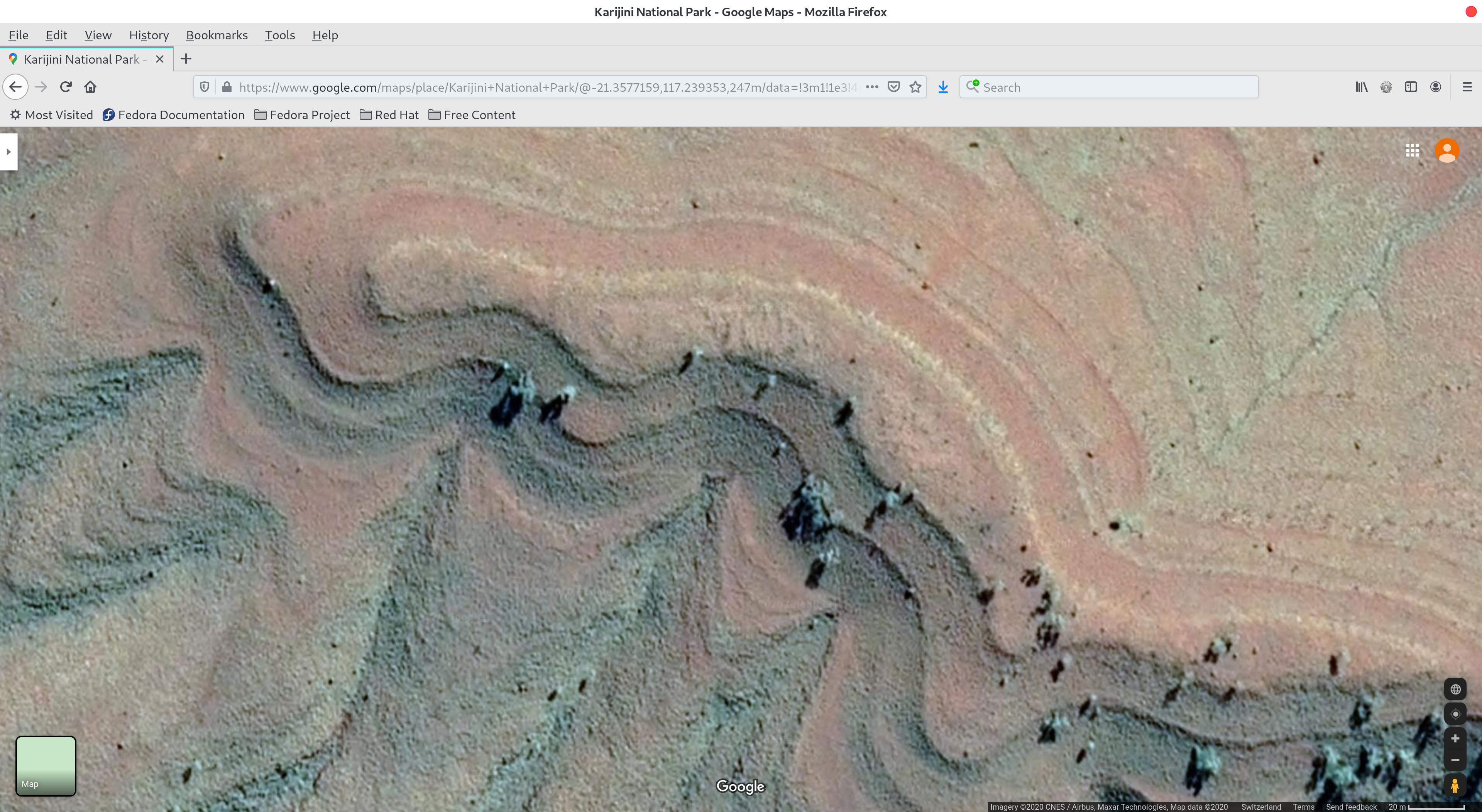
Note some of the perfect curves in the above three images (Figures 3,4 & 5).

Figure 5: Millstream Chichester National Park - Google Maps
Figure 6: Millstream Chichester National Park – Google Maps – The angles (ie the almost 90-degree one towards the right-hand side) and shapes do not appear to be of natural origin
Figure 6: Millstream Chichester National Park - Google Maps - Close-up of Figure 5
Figure 7: Millstream Chichester National Park – Google Maps – Close-up of Figure 6
Figure 7: Millstream Chichester National Park - Google Maps - Huge terraced circular formation
Figure 8: Millstream Chichester National Park – Google Maps – Large terraced circular formation

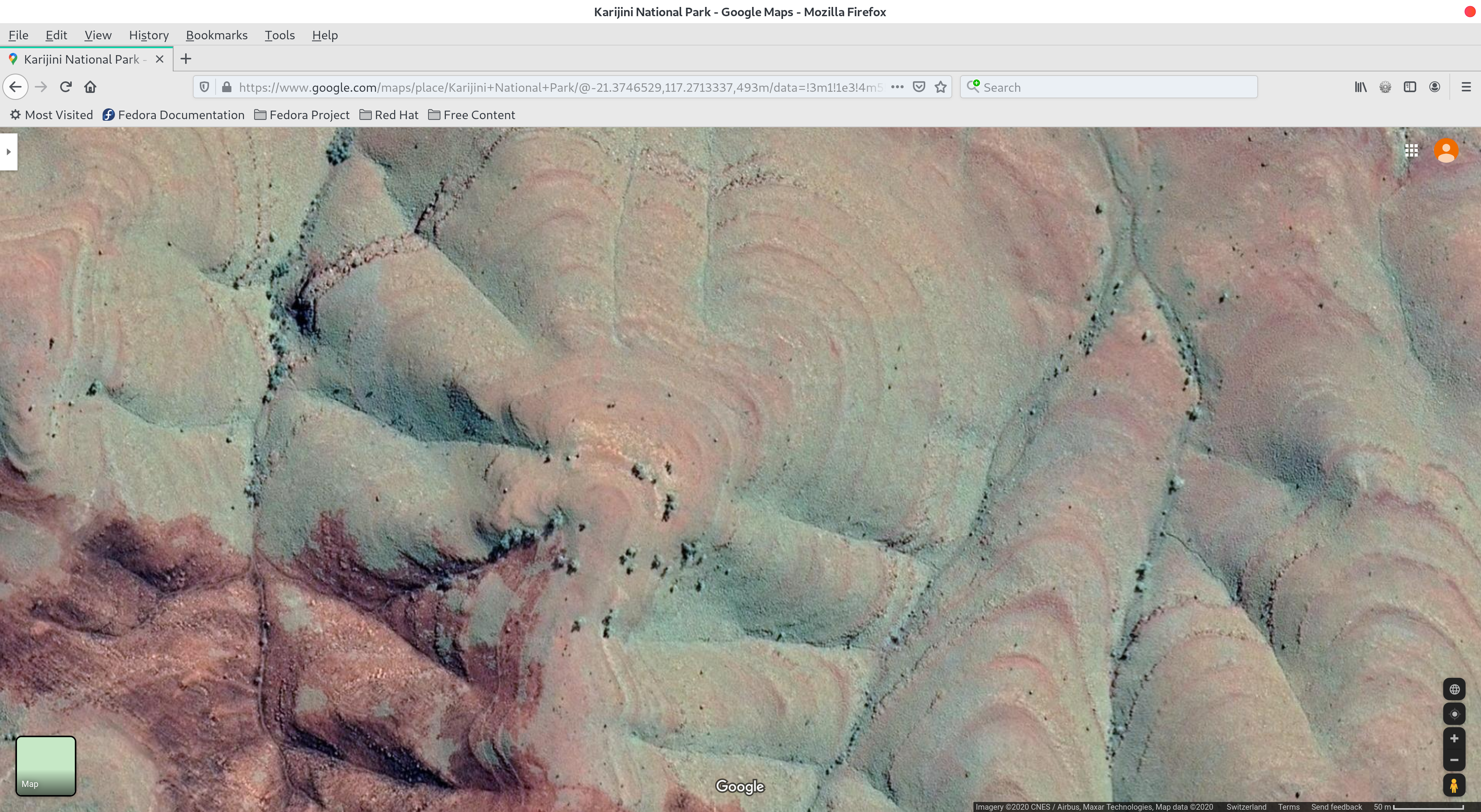
We showed a similar circular terraced formation (as part of a larger structure as above in Figure 8) in Northern Siberia in Part 1 of this series of posts which can be found here.

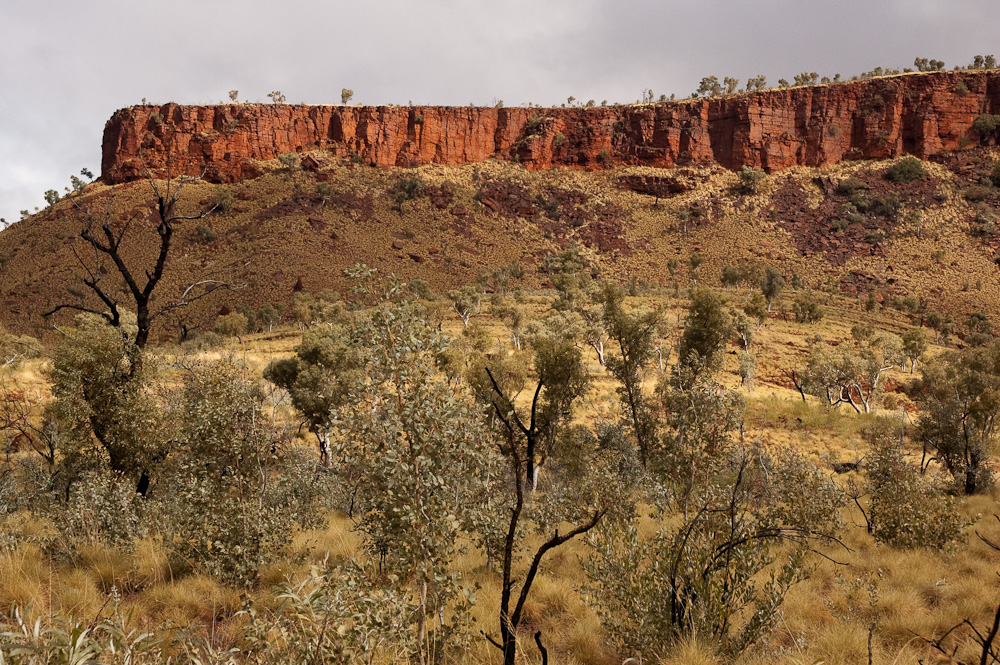
Here are some pictures of what it looks like at ground level in this area:

Figure 9: Millstream Chichester National Park
Figure 9: Millstream Chichester National Park – Remains of terraced/domed structures
Figure 10: Millstream Chichester National Park
Figure 10: Millstream Chichester National Park – Note the shape of the top part of the landscape
Figure 11: Millstream Chichester National Park
Figure 12: Millstream Chichester National Park